
An overview of their solutions for citizens
Just imagine: on a spring day, it’s announced that the level of the Saint-Maurice River, which flows through the city of Trois-Rivières, will rise by 2 meters in the next 24 hours. Residents living along the river are in shock. They will barely have time to pack a few belongings before leaving their homes.
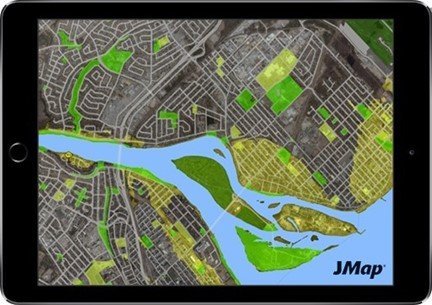
Jmap, the cartographic integration platform developed by K2 Geospatial, which enables the Trois-Rivières public safety department to plan intervention and communications.
Used by almost 500 organizations worldwide, the JMap platform enables digital terrain models to be visualized and analyzed, making it possible to identify in seconds which properties are likely to be flooded by a sudden surge of water. This information, combined with other datasets (topography, infrastructure, buildings, etc.), helps civil security analysts to plan communications with citizens and emergency interventions.
Jmap then communicates with a call center, which informs the residents concerned and enables emergency services to be deployed more rapidly to the right places. The use of the platform thus enhances the ability to intervene in collaborative mode, in real time(real-time ability-to-act).
JMap also enables responders to plan ahead for available accommodation (arenas, schools, etc.) for the temporary relocation and safety of disaster victims.
K2 Geospatial and CRIM
CRIM and K2 Geospatial share a desire to democratize access to geospatial data. Their respective initiatives focus on system interoperability based on the standards of theOpen Geospatial Consortium (OGC).
Indeed, it’s not surprising to see the two organizations sitting at the same OGC round tables, as was the case at CRIM’s latest presentation of the data architecture project.
At K2 Geospatial, we are very sensitive to all aspects of climate change for our customers. The depth of CRIM’s data ensures quality and accuracy in communications and interventions.
– Jacques Charron, President and Founder of K2 Geospatial
K2 Geospatial is even considering a collaboration with CRIM by connecting its JMap platform to CRIM’s Donneesclimatiques.ca service, developed in collaboration with Environment and Climate Change Canada and Ouranos, regional climatology consortium “We are proud to provide accurate and relevant information that enables public decision-makers to take action in the face of climate change.” Françoys Labonté, President and CEO of CRIM.
The K2 Geospatial team believes that its customers, mainly cities and municipalities (MRCs), have a vested interest in using ClimaticData.ca to access useful, actionable information. The two organizations will be demonstrating JMap-DonneesClimatiques.ca integration in real time at the 9th Virtual User Conference on October 28, 2020. “At K2 Geospatial, we’re very sensitive to everything to do with climate change for our customers. The depth of CRIM data ensures quality and accuracy in the communications and interventions to be implemented. For example, it enables us to quickly identify infrastructures at risk, such as buildings, power lines, roads, bodies of water, bridges, etc.” Jacques Charron, President and founder of K2 Geospatial.
Read also: Building the Quebec City 2.0 with climate data (L’actualité, November 6, 2020)